Citizen Science with Geographic Information Systems and associated technologies (GIS&T)
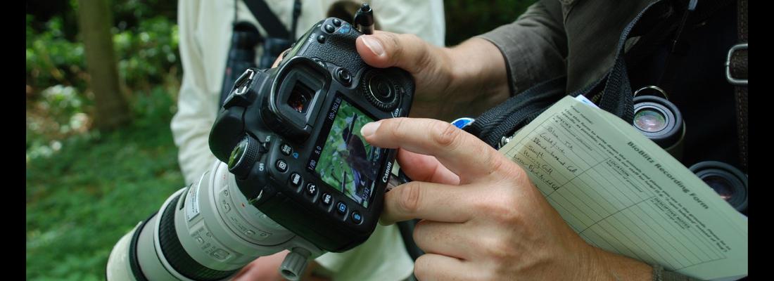
Citizen Science is defined as the participation of non-professional volunteers in scientific projects (Dickson et al, 2010) and has experienced rapid growth over the past decade. The projects that are emerging in this area range from contributory projects, co-created projects, collegiate projects, which are initiated and run by a group of people with a shared interest, without any involvement of professional scientists. In many citizen science projects, Geographical Information Systems and association Technologies (GIS&T) is enabling the collection, analysis, and visualisation of spatial data to affect decision-making. Some examples may include: Recording the location of invasive species or participating in a BioBlitz to record local biodiversity (Figure 1). Measuring air quality or noise over a large area and over time to monitor local conditions and address them Using tools to educate on and increase access to local resources, improving community resilience Such projects have the opportunity to empower or disempower members of the public, depending upon access to and understanding of technology. Citizen Science projects using GIS&T may help communities influence decision makers and support the gathering of large-scale scientific evidence on a range of issues. This may also renew people’s interests in the sciences and foster continued and lifelong learning.
Publish information
| Authors: | P Rickles; M Haklay; A Skarlatidou; C Ellul; |
| Publisher: | UCGIS |
| Year of publication: | 2019 |
| License: | CC-BY, |
| DOI: | doi: 10.22224/gistbok/2017.3.5 |