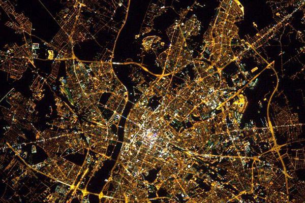
Cities at night
from 15/07/2014
The project to tag, locate and georeference the night time ISS images is coordinated with NASA and ESA. The images taken by the astronauts at the International Space Station have between 3 and 150 times more resolution than the most popular current instrument, the NOAA/NASA SNPP/VIIRS-DNB. And the only public source of images of the earth in color since 2003 until today from the orbit. Although, the scientific use of this data is limited because of the difficulty to find the images on the NASA archive, where more than 3M images are stored with a location with a typical error of 500 km of radius. The Cities at Night project use a three stage technique to tag, locate and georeference the night time images. The first stage is called Dark Skies and it’s gamificed version, nightknights. This stage aims to tag the night time images to distinguish between images of cities, stars or other. The second stage is called “Lost at Night” and aims to locate the images of cities. Currently we are running the second version of this stage. The last stage is called “Night cities”.This stage aims to georeference the images so can be used as maps. With all this images, we want to create the first world map in color of the night. The use of citizen science is at the same time a tool to teach geography, increase awareness about the light pollution problem and a power full resource, as humans do not need to be trained to make most of the tasks required. The applications of this night time images go from light pollution control, cancer epidemiological studies, civil safety, biodiversity protection, child development, energy studies.
Aim
The main goal of the project is to tag, locate and georeference the archive of night time images of the Astronauts of the International Space Station. At NASA’s archive there is more than 3M images and less than 10% are located. In general, currently is impossible to make all this tasks using machine learning or computer vision or manually by small group of people because of the size of the archive and lack of references. Although, the night time images of the International Space Station are the most powerful public archive of night time images available. This images also provide an unique and new perspective of the earth from the space that we are sure that will inspire new generations of scientist and will be very helpful to increase the awareness about light pollution. In the line of citizen science, the active contribution of volunteers is essential in this project, to achieve the expected scientific results. The project includes disclosure at various levels:
- To participate in the process, any volunteer requires a brief explanation that presents the problem in which they are going to participate and the scientific interest that their resolution represents.
- There is material to disseminate the project that is accessible from the website.
- Specific material is prepared for ESO and / or Baccalaureate students who will collaborate in the process.
- Specific material is prepared that allows any citizen to carry out their own research with the analyzed data.
Needed equipment
Internet or a phone
Created May 11, 2021, 10:38 a.m.
Updated Dec. 13, 2021, 12:43 p.m.


