On Drought (Na suchu)
On Drought (Na suchu) is a citizen science project investigating the current state of the agricultural landscape.
Whether you are a farmer, a farm landowner, or a random passerby, we will be happy if you get involved by taking photos directly in the field in agricultural areas and uploading it on the iNaturalist app. For observation, we are interested in 6 main categories:
-
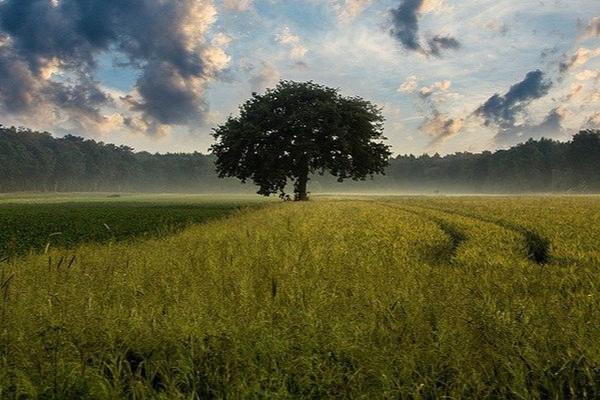
Solitary trees that are planted in the agricultural landscape in order to retain more moisture for cultural crops.
-
Crops occurring in the fields. This category is further divided into two sections, indicate whether it is a monoculture (all around you, i.e. there is only one crop in the whole field) or, conversely, a combination of several crops.
-
Biobelts and embankments. Their area is never harvested, they contribute to biodiversity and are also one of the anti-erosion measures. By embankment is meant a smaller area within the field, on which are planted mainly tree species. They have a beneficial impact on the surrounding landscape. They act as windbreaks, reduce water and wind erosion, are a source of food and nutrients, therefore contribute to biodiversity, help to retain water in the field and at the same time prevent the washing of nutrients into watercourses and groundwater.
-
Restoring dirt roads. As a result of the intensification of agriculture, dirt roads have almost disappeared from the agricultural landscape. However, dirt roads also have enormous benefits for the agricultural landscape. They serve as bunds to protect fields from water erosion. By planting shrubs and trees along the roads, the effects of wind erosion are reduced and water retention in the landscape is promoted.
-
Building pools and areas that could be used to retain water in the agricultural landscape. These include swales, which are ditches that retain rainwater. The aim of swales is to prevent water from running down the surface into the valley and soaking into the soil.
-
Planting fruit trees in agroforestry fields. This is a method of farming on agricultural (or forest) land that combines the growing of trees with some form of agricultural production on a single plot, either spatially or temporally.
We welcome all those who will participate in the research and help scientists, farmers and landowners to jointly reduce the negative impacts of drought on the Czech agricultural landscape and preserve the fertility and cultural profitability of Czech fields for future generations.
Thank you and we look forward to your observation!
Aim
To jointly create a database monitoring the impacts of drought in Czech agriculture, to share examples of bad and good practices and thus contribute to a better future in the field of water retention in the landscape, a better yield of fields and more ecological management.
Needed equipment
Mobile phone with a camera.
About funding
Funding bodies: Tomas Bata University
Masaryk University Mendel University Research Institute of Geodesy; Topography and Cartography; v. v. i. Institute of Geonics; CAS envipor Association of Private AgricultureCreated July 14, 2022, 1:28 p.m.
Updated Dec. 23, 2022, 6:21 p.m.